Walks
Walks index > Walks in and around Ashby de la Zouch
I'm always adding, there's lots more to come!
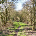
Ashby Ivanhoe 5m circular walk
Distance: 5 miles
Terrain: Easy; road, field and National Forest. Parts can be muddy after wet weather.
Location: Ashby de la Zouch, Derbyshire / Leicestershire border
Map: Ordnance Survey Explorer 245 (National Forest)
Albert Village circular walk
Distance: 5 miles
Terrain: Easy, mostly surfaced and forest paths.
Location: Derbyshire / Leicestershire border close to Albert Village
On map: Ordnance Survey Explorer 245 (National Forest)
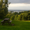
Ticknall Circular Walk
Distance: 6 miles
Terrain: some gentle inclines, stiles, fields
Location: Foremark Reservoir, South Derbyshire
On map: Ordnance Survey Explorer 245 (National Forest)
Staunton Harold Walk
Distance: 6.1 miles
Terrain: Easy, but quite a bit of road.
Location: Derbyshire / Leicestershire border close to Melbourne, Calke, Staunton Harold
On map: Ordnance Survey Explorer 245 (National Forest)
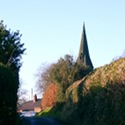
Blackfordby Spire Walk
Distance: 7.2 miles
Terrain: Some inclines, stiles
location: Shellbrook, Ashby de la Zouch, Leicestershire [location map]
Time: 2.5 hours
Map: Ordnance Survey Explorer 245 (National Forest)
Ashby Ivanhoe 10m circular walk
Distance: 10 miles
Terrain: Easy; road, field and National Forest. Parts can be muddy after wet weather.
Location: Ashby de la Zouch, Derbyshire / Leicestershire border
Map: Ordnance Survey Explorer 245 (National Forest)
Ashby Woulds 11m Circular
Distance: 11 miles
Terrain: Good; cyclepath, woodland, surfaced paths and road, meadow
location: Shellbrook, Ashby de la Zouch, Leicestershire [location map]
Time: 2.5 hours
Map: Ordnance Survey Explorer 245 (National Forest)
South Derbyshire Viewpoints Walk
Distance: 14 miles
Terrain: Some fields and woods, some inclines
Location: South Derbyshire
Time: 6 hours start to finish
On map: Ordnance Survey Explorer 245 (National Forest)
South Derbyshire 18 Walk
Distance: 18 miles
Terrain: Some fields and woods, some inclines
Location: South Derbyshire.
Time: 8 hours start to finish
On map: Ordnance Survey Explorer 245
Ivanhoe Way
Distance: 36 miles
Time: 14 hours
Terrain: some inclines, stiles
Starting location: Anywhere en route, suggest Ashby de la Zouch, Leicestershire [location map]
Map: Ordnance Survey Explorer 245 (National Forest)
Unlimited listening to thousands of titles:
