Walks
Walks index > Circular Walks around Rutland Water
I'm always adding, there's lots more to come!
You may prefer to view the interactive map version of this page.
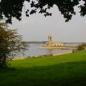
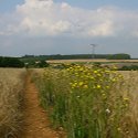
Rutland Water Walk
Distance: 17 miles, or 26 miles if you walk the optional peninsula path
Terrain: Easy
Location: Rutland / Leicestershire
On Map: Ordnance Survey Explorer 234
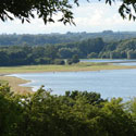
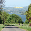
Rutland Water Hambleton Peninsula Circular Walk
Distance: 7 miles
Terrain: Flat, surfaced paths and good woodland paths
Location: Rutland / Leicestershire
On map: Ordnance Survey Explorer 234
Rutland Water Egleton Circular Walk
Distance: 5.5 miles
Terrain: a gentle climb to 165m
Location: Rutland / Leicestershire
On Map: Ordnance Survey Explorer 234
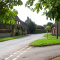
Rutland Water Brooke Circular Walk
Distance: 5.4 miles
Terrain: gentle incline to about 40 metres above starting point
Location: Rutland / Leicestershire
Map: Ordnance Survey Explorer 234
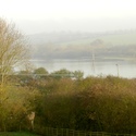
Rutland Water Empingham Circular Walk
Distance: 6.5 miles
Terrain: fairly flat
Location: Rutland / Leicestershire
On map: Ordnance Survey Explorer 234
Rutland Water Normanton - Empingham Circular Walk
Distance: 7 miles
Terrain: fairly flat, mostly road and surfaced path
Location: Rutland / Leicestershire
On map: Ordnance Survey Explorer 234
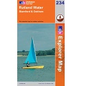
These walks use Ordnance Survey Explorer 234 Rutland Water
1:25,000 scale map Rutland Water. Includes Stamford and Oakham. Click the thumbnail for more images
Unlimited listening to thousands of titles:
