Walks
Walks index > Walks in Wales and Snowdonia
I'm always adding, there's lots more to come!
You may prefer to view the interactive map version of this page.
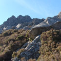
Tryfan Circular Walk
Distance: 5 miles
Terrain: climb to 900m
Location: Conwy, Wales
On map: Ordnance Survey Explorer OL17 (Snowdon)
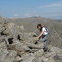
Bristly Ridge Circular Walk
Distance: 5 miles
Terrain: hilly
Location: Conwy, Wales
On map: Ordnance Survey Explorer OL17 (Snowdon)
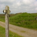
Offa's Dyke Path (north) Knighton to Prestatyn
Distance: 97 miles
Terrain: Varies considerably; hill, moor, forest. Generally a good well-maintained path but has steep climbs and descents and many stiles.
Location: English / Welsh Border, Shropshire, Powys, Denbeigh, Clwyd
Time: around a week
On map: Explorer 201 (Knighton and Presteign), Explorer 216 (Welshpool and Montgomery), Explorer 240 (Oswestry), Explorer 256 (Wrexham), Explorer 265 (Clwydian Range). The National Trail Guide: Offa's Dyke Path North contains 1:25,000 maps covering this path.
Unlimited listening to thousands of titles:
