Walks
South Derbyshire Three Viewpoints Circular Walk
Distance: 14 miles
Time: 6 hours start to finish
Terrain: Some fields and woods, some inclines
Location: South Derbyshire. Staunton Harold and Foremark Reservoirs
Map: Explorer 245 (National Forest)
My last walk: 29 Sep 2012
Summary:Starting from the round car park to the south of Staunton Harold Reservoir (first viewpoint). Head for Breedon Church (second viewpoint). Via Melbourne through Robin Wood to Foremark Reservoir. Pause where the wicker Jack and Jill used to be and the abandoned car park at the South of Foremark Reservoir (third viewpoint). Back past the Calke estate to the finish.
[Update Sep 2012: I've marked the three viewpoints on the map below, and have made two changes to the route; taking the Ivanhoe Way just before Scotland Farm and turning into the Craft Centre driveway and going through Diminsdale Nature Reserve near the end rather than using the road there.]
This walk could be called 'Two Reservoirs Walk' or just 'Viewpoints Walk' because there are more than three viewpoints.
 The first viewpoint is the start / finish point: the round car park to the south of Staunton Harold Reservoir. It's marked on the map below as a car park / viewpoint, just north of Dimminsdale. The first mile is unfortunately along roads, but they're quite quiet. Head back along the road, (past an eye-catching newly-thatched cottage roof) and turn left at the bend to pass Dimminsdale Nature Reserve, which is noted for its carpet of snowdrops early in the year, and old lime kilns. It's just a few yards from the road and worth a look. Cross the valley bottom. Follow the road and pick up the Ivanhoe Way signs just before Scotland farm, SK386222. Then where five paths meet, take the diagonal option - heading directly for Breedon Church.
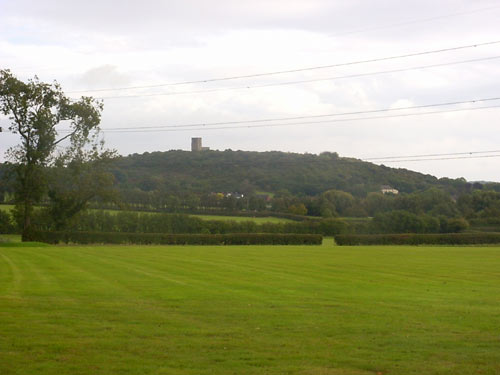 Follow footpaths which take you in pretty much a straight line across fields and a golf course towards Breedon church and its curious bump of a hill.
Paths bring you out on the road at the entrance to the golf course and, a little further, a garden centre which has a tearoom and loos. As you start to climb the hill, the ground is open access land. There are several paths which take you up and back down the hill. Because it's such a steep climb, you find yourself at the top surprisingly quickly! The view from the top of the hill includes Donington Racetrack and East Mids Airport and of course the church itself.
It's well worth making time to look inside the church - it is home to a wonderful collection of Saxon stone carvings. Leave the top of the hill by finding the path to the north-west of the church. You'll cross a road half-way down and then come out on a tarmac road at the bottom. Walk north along this road just a short way to find the very well-marked path across another golf course. Follow paths in pretty much a straight line which take you over a ridge and down into the historic and beautiful Melbourne.
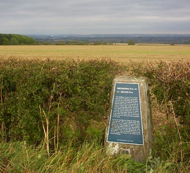 Pick up the footpath at SK375249, which takes you past St Bride's and a trig point which has a plaque on it which tells you all about it. The history lesson on the trig point is a bonus! Turn around and look behind you - the view from this point is worth a look.
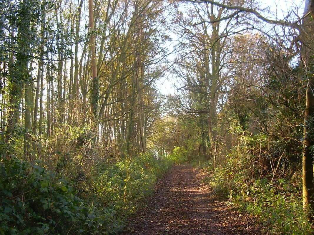
The path which goes directly through Robin Wood can be a muddy quagmire, and is muddy even in dry weather. In the winter it's worth finding another way around.
 Pass Seven Spouts Farm, Hangman's Stone and Bendall's Farm.
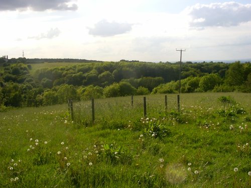
 The picnic spot in the new Lamont Wood (approx SK337245) is perfect for a break; secluded and affording good views.
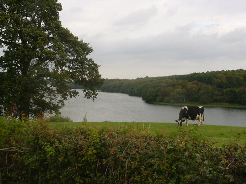
 There used to be a 'wicker' Jack and Jill on this path towards the bottom end of the reservoir. Their wishing well is still there (although a bit overgrown) and just past this, the view over the reservoir from the picnic spot just a little further on is is the third viewpoint
You'll find yourself in an abandoned car park - permanently locked. I have heard that this is because of night-time misuse. It's actually quite fascinating to see nature reclaiming this area - moss growing over the tarmac and grass coming through it.
If time and legs allow, do locate Carver's Rocks, especially if you like a scramble. It's good fun climbing up the rocks.
The footpath brings you out on the Hartshorne -> Ticknall road (A514). Cross and find the path which takes you past the Scaddows Farm, briefly onto a road before crossing fields to Ticknall, straight across a road and then across more fields to Calke Abbey estate. Look for a gap in the dry-stone wall which would take you into the National Trust property. Carry on walking due south and across fields (marked in pink on the map below), you'll come out onto minor roads which you can follow back to the start point.
blog posts about this walk:
- http://peacockmedia.blogspot.co.uk/2012/09/south-derbyshire-three-viewpoints-walk.html
- http://peacockmedia.blogspot.com/2006/09/3-viewpoints.html
- http://peacockmedia.blogspot.com/2007/11/3-viewpoints-mark-2.html
- http://peacockmedia.blogspot.com/2007/09/3-viewpoints.html
- http://peacockmedia.blogspot.com/2008/03/three-viewpoints-again.html
- http://peacockmedia.blogspot.com/2008/06/summer-solstice-dusk-till-dawn-walk.html
- http://peacockmedia.blogspot.com/2009/06/long-walk-on-short-night-summer.html
View / download the route
Below is an interactive map with the route shown on it, which you can make full-screen. To take a paper map with you at the best detail, you will need an explorer (1:25,000) map. Please use the link below to buy a copy. Below the map is a link to download the GPX file which you can open in many mapping and navigation apps, including OsmAnd (Open Street Map) and OSMaps (Ordnance Survey)
Download GPX file for the 3 Viewpoints Walk
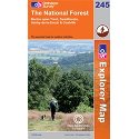
Ordnance Survey Explorer 245 The National Forest
1:25,000 scale map incuding The National Forest, South Derbyshire, Burton upon Trent, Swadlincote, Ashby de la Zouch, Coalville. Both of South Derbyshire's reservoirs, Foremark Reservoir and Staunton Harold Reservoir. The whole of Ivanhoe Way is clearly marked.
Note that OS paper maps now include the digital / mobile map, downloadable and viewable *offline* in the OSMaps app. The routes provided on these pages in GPX format will open and display over the digital mapping in the OSMaps app.
Unlimited listening to thousands of titles:
